We work with various industries. We help in solving problems related to the results of laser scanning and processing of a point cloud.
Impressive opportunities
See where our knowledge and results are being applied. Point cloud processing helps with any task.
Models
creation of three-dimensional models of complex engineering structures and technological equipment with a high degree of detail and accuracy
Surveing
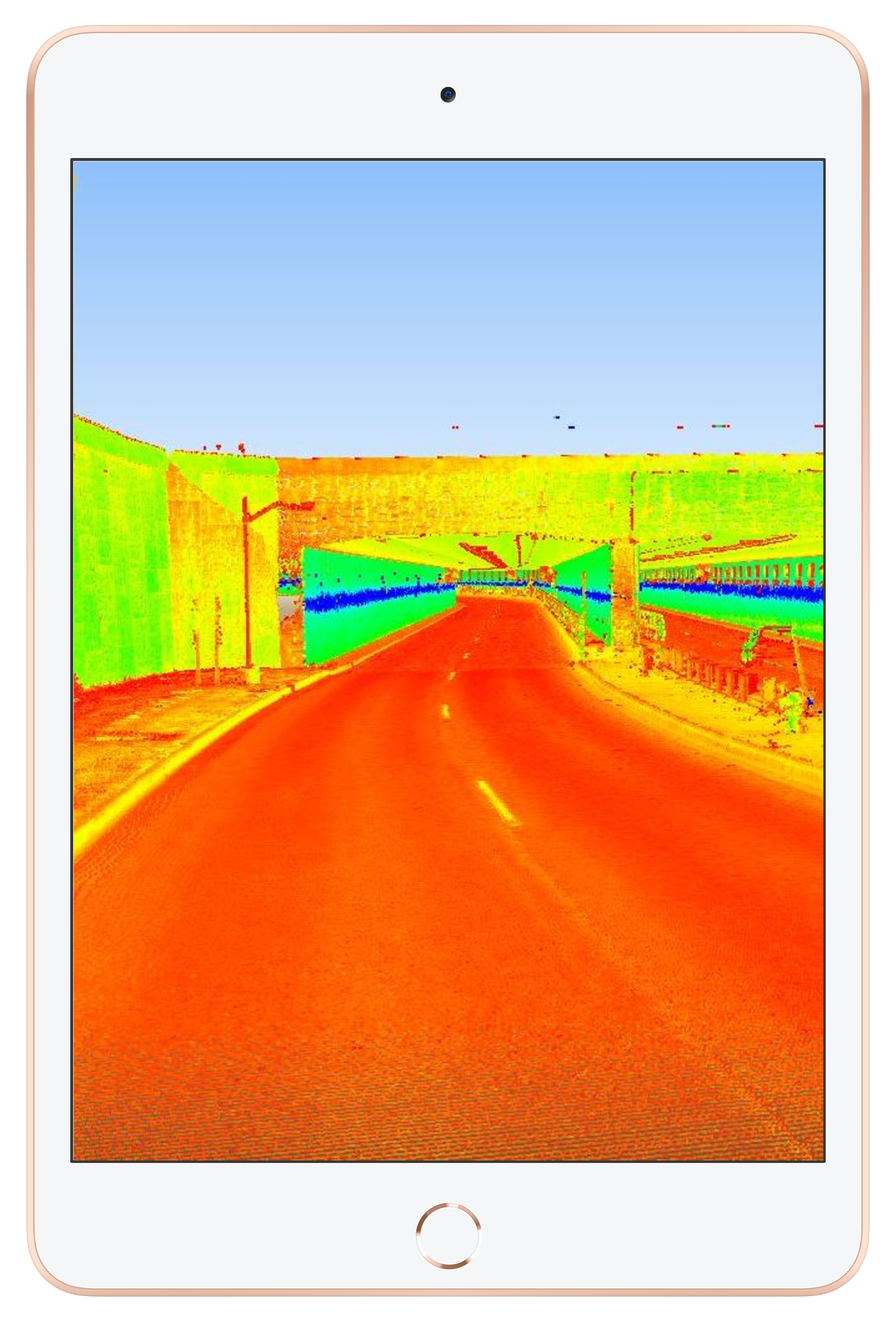
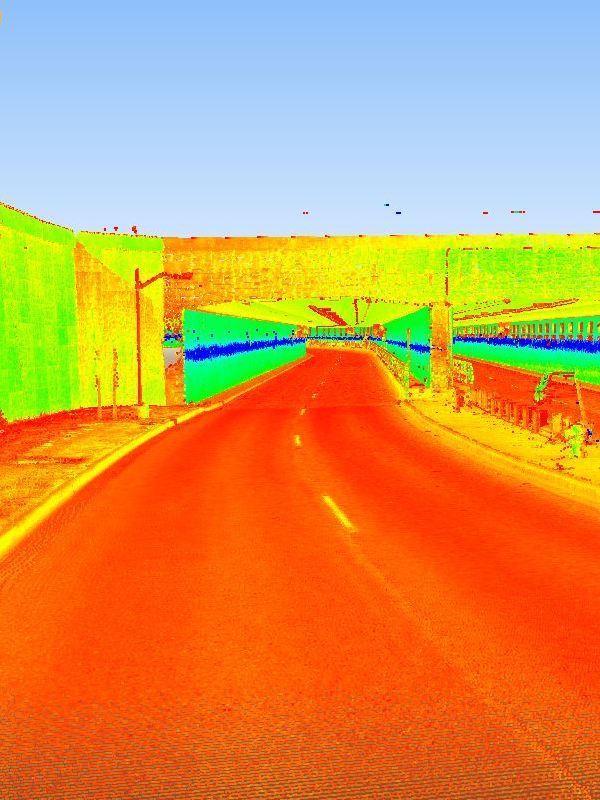
surveying the facades of historic buildings, monuments and unique objects for their reconstruction
Reducing
Costs when performing executive and topographic surveys. Fast results
Cycle of work
Reducing or completely eliminating repeated additional surveys of the object, reducing the overall cycle of work on the project
Accuracy
Obtaining more accurate and complete results of executive shooting and, as a result, eliminating ambiguities during office work
Safety and quality
A high level of detail and improved quality of the result, safety of work when shooting
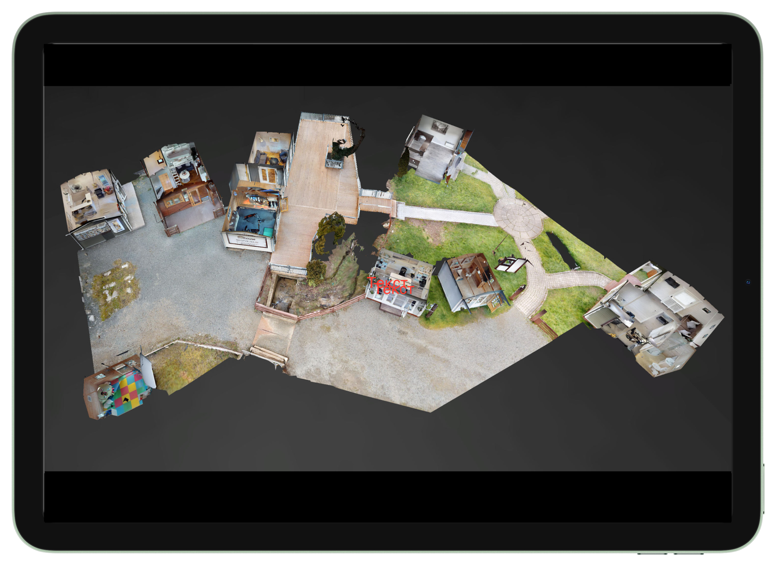
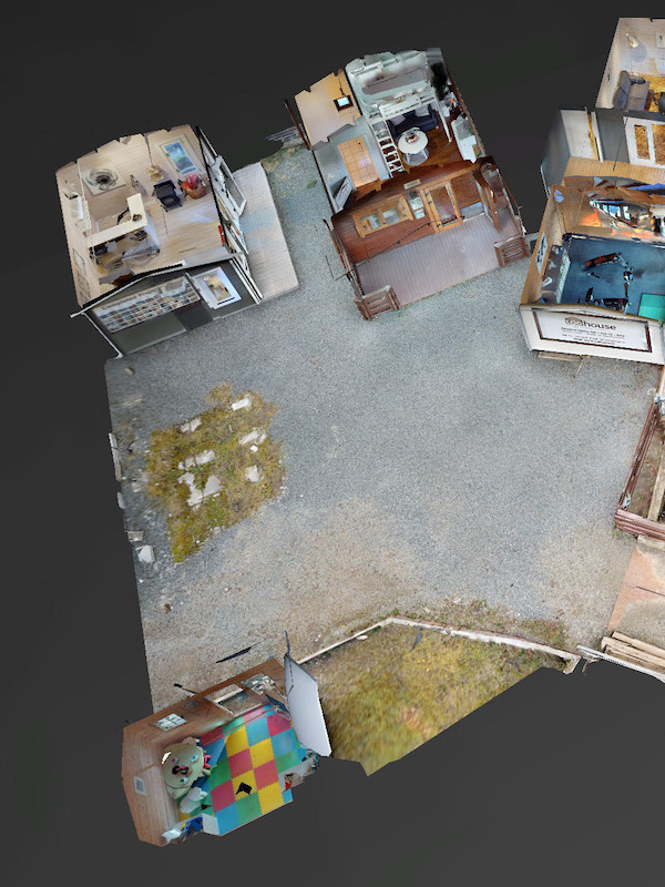
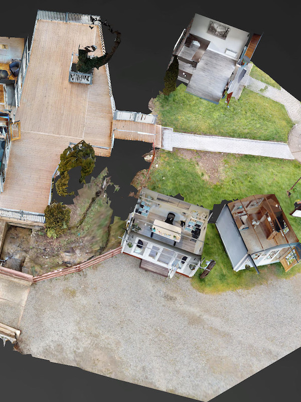
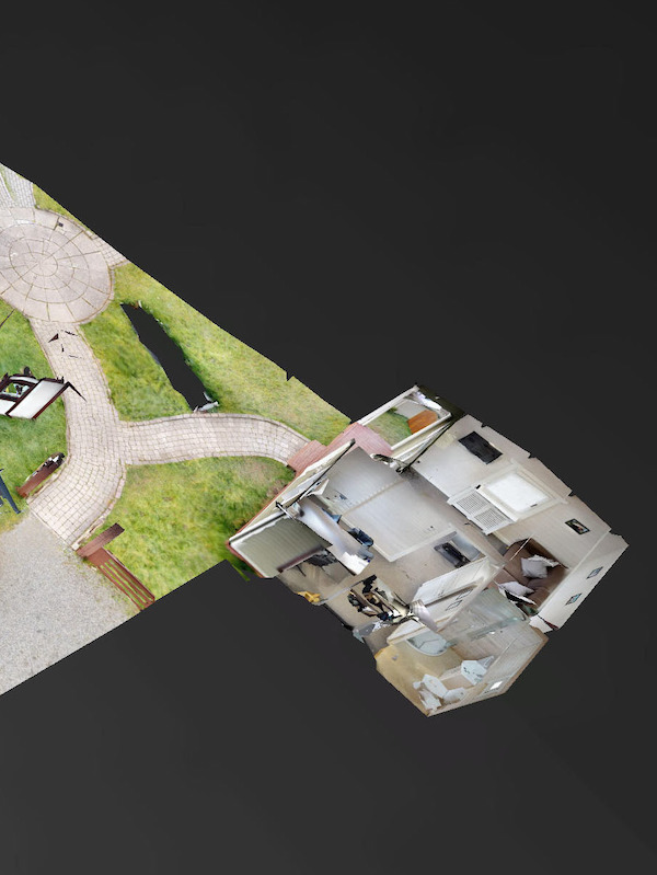
PRIVATE COURTYARD MODEL
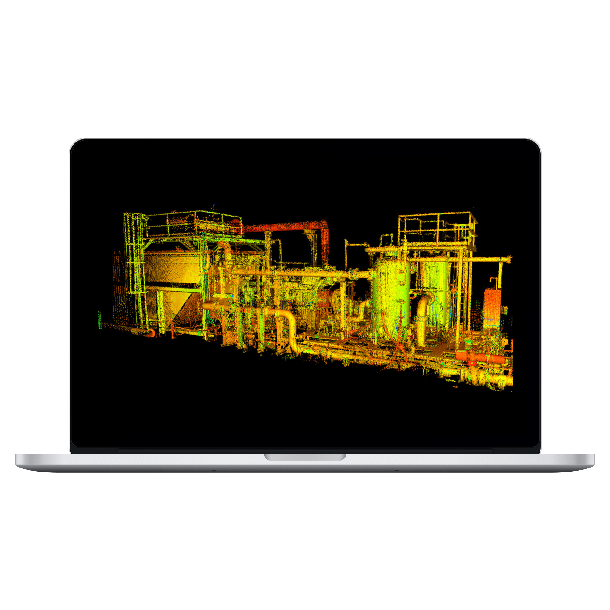
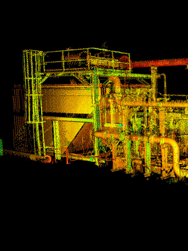
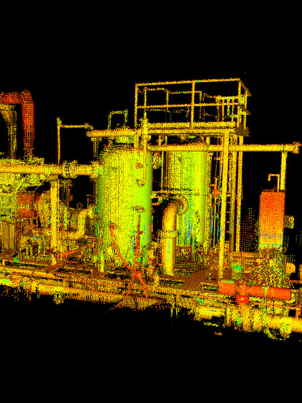
The method of operation of modern laser rangefinders used in scanners is based on impulse and phase reflectorless distance measurement methods. During scanning, the direction of propagation of the laser beam and the distance to the points of the object are recorded. The result of the scanner's operation is an array (cloud) of laser reflection points from objects in the scanner's field of view, with five characteristics, namely spatial coordinates (x, y, z), intensity and real color. Typically, the actual color characteristics for each point are obtained with a digital camera.INDUSTRIAL SYSTEMS SURVEING
Scanning factory premises allows you to carry out a large list of useful work that can only be done in this way. Scanning of plant shops helps to make a complete update of the master plans of the plant premises, including scanning of underground utilities. Scanning the walls of factories, scanning equipment and scanning structural structures allows you to see hidden flaws and problems that cannot be seen with the naked eye.